

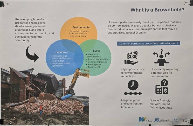
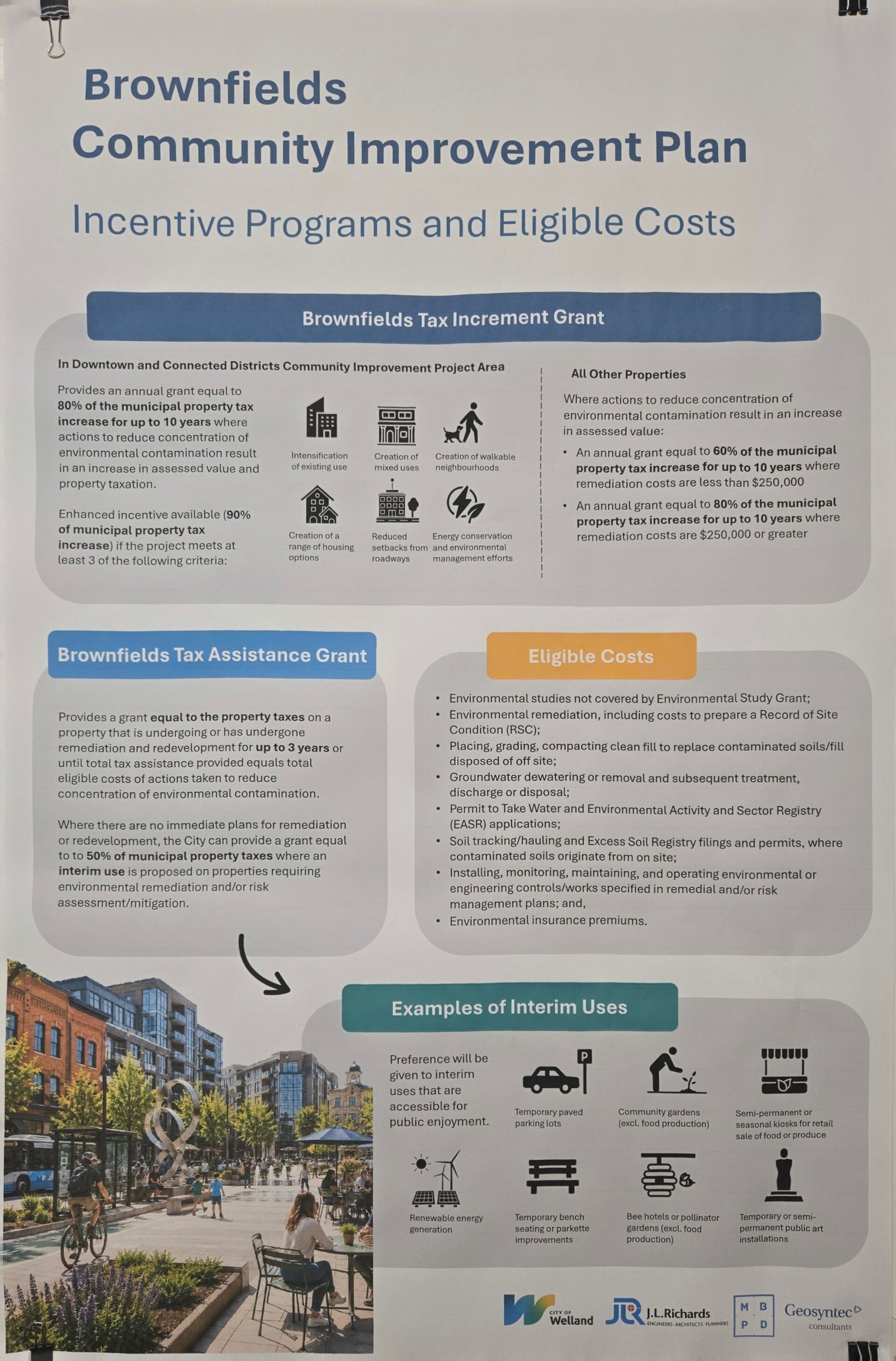
Municipal open houses often reveal a striking contradiction in urban development strategy: the proposal to construct residential neighborhoods on contaminated brownfields while simultaneously paving over prime agricultural land for industrial parks.
While brownfield redevelopment is frequently promoted as a "win-win" for urban renewal and environmental stewardship, swapping land uses in this manner presents severe long-term public health and ecological risks. Placing homes where heavy industry once operated—while consuming irreplaceable farmland for new factories—is a flawed planning model.

Historical Cautionary Tales: Statistical Health Impact of Residential Brownfields
Proposing residential housing on former industrial lands ignores some of the most alarming lessons in modern environmental health. Across North America, converting heavily contaminated industrial sites or using industrial waste as residential fill has repeatedly led to toxic exposure, severe public health crises, plummeting property values, and multi-million-dollar government buyouts
HISTORICAL RESIDENTIAL BROWNFIELDS & HEALTH IMPACTS
| COUNTRY | LOCATION | ISSUE |
|---|
CANADA
Sydney Tar Ponds (NS)
Cancer rate 45% above provincial average (highest in Canada); coal tar/PAHs oozing into residential cellars.
Malvern / McClure (ON)
Radiation up to 10x background levels; basement radon reaching 7.1 pCi/L; 16,000 m³ radioactive soil.
Port Hope (ON)
Radium/uranium fill in yards; massive PHAI initiative to mitigate long-term lung cancer risks from radon.
UNITED STATES
Love Canal (NY)
17.5% birth defect rate; 56% infant defect/anomaly rate (1974-78); elevated bladder & kidney cancers.
Lipari Landfill (NJ)
EPA #1 Superfund site; toxic VOC vapors; statistically elevated low birth weights & respiratory illness.
Ringwood Mines (NJ)
Toxic paint sludge & lead; severe chronic illness & rare cancers in residential tribal community.
Raymark Site (CT)
Lead 100x above safe residential limits; PCBs/dioxin fill across hundreds of private yards & parks
Canadian Case Studies & Health Data
1. Sydney Tar Ponds & Whitney Pier (Sydney, Nova Scotia)
Over a century of steel production and coke oven operations deposited over 700,000 tonnes of toxic sludge contaminated with polycyclic aromatic hydrocarbons (PAHs), heavy metals, and polychlorinated biphenyls (PCBs). Residential neighborhoods, including Whitney Pier and homes along Frederick Street, sat directly adjacent to or on land impacted by migrating coal tar.
- Health Concerns & Toxic Pathways: Chemical sludge oozed into residential basements and backyards. Airborne particulates contained heavy metals and volatile organic compounds.
- Statistical Health Issues: Epidemiological data revealed that residents in the Sydney area experienced a local cancer rate 45% higher than the Nova Scotia provincial average—at the time, the highest recorded cancer rate in Canada. Research indicated that proximity to the coke ovens resulted in local workers and nearby residents inhaling particulate matter equivalent to smoking 30+ packs of cigarettes per day. Remediation required over $380 million in government interventions.
2. Malvern / McClure Crescent (Scarborough, Toronto, Ontario)
In the 1940s, a WWII radium dial recovery plant operated on farm property in Scarborough. In 1974, townhomes were constructed over the site for residential housing without adequate decontamination.
- Health Concerns & Toxic Pathways: Radium-226 decay produces gamma radiation and radon gas, a known Class 1 human carcinogen. Children played directly in backyards containing radioactive slag.
- Statistical Health Issues: Surface radiation surveys conducted after discovery revealed gamma radiation readings up to 10 times natural background levels (exceeding 100 µR/hr in hotspots and up to 60,000 CPM in sub-surface boreholes vs. 8,000 CPM background). Radon gas testing in basement living spaces recorded concentrations as high as 7.1 pCi/L (nearly double the action threshold). The site required emergency resident relocations, property buyouts, and the excavation of 16,000 cubic meters of radioactive soil across 60 residential properties.
3. Port Hope (Municipality of Port Hope, Ontario)
From the 1930s to 1950s, radium and uranium refining residue from Eldorado Nuclear was freely distributed as residential "fill" dirt for yards, gardens, and home foundation construction throughout the town.
- Health Concerns & Toxic Pathways: Chronic low-level gamma radiation exposure, toxic heavy metals (arsenic, uranium), and internal alpha radiation exposure via indoor radon gas inhalation.
- Statistical Health Issues: While comprehensive Health Canada epidemiological synthesis studies indicated overall town-wide cancer incidence rates aligned closely with Ontario averages, the presence of radioactive fill across hundreds of private properties posed an unacceptable chronic risk for lung cancer and renal toxicity. This triggered the creation of the Port Hope Area Initiative—a multi-billion-dollar federal environmental remediation project to test and excavate low-level radioactive waste from private residential yards.
U.S. Case Studies & Health Data
1. Love Canal (Niagara Falls, New York)
Hooker Chemical buried over 21,000 tons of toxic industrial waste (including dioxins, benzene, and organochlorine pesticides) in an abandoned canal trench. The site was subsequently capped with dirt and developed into a elementary school and residential neighborhood.
- Health Concerns & Toxic Pathways: Chemical leachate breached basement walls, surfaced in puddles, and volatilized into toxic vapors inside homes.
- Statistical Health Issues: Epidemiological studies led by Dr. Beverly Paigen documented that 17.5% of children born in the active area had congenital birth defects (compared to ~2-3% baseline). For children born between 1974 and 1978 in high-risk swales, defect and severe developmental anomaly rates reached 56%. Miscarriage rates among pregnant residents spiked to over 25-30% (8 out of 64 women experienced three or more miscarriages). Long-term follow-up studies by the New York State Department of Health confirmed elevated risks for bladder and kidney cancers among adults exposed during childhood.
2. Lipari Landfill / Chestnut Branch Estates (Mantua Township, New Jersey)
An unlined 6-acre gravel pit was filled with 3 million gallons of liquid chemical waste, solvents, and industrial sludge, adjacent to which the Chestnut Branch Estates residential subdivision was built.
- Health Concerns & Toxic Pathways: Volatile organic compounds (VOCs) such as bis(2-chloroethyl) ether, benzene, and toluene leached into groundwater, surface streams, and basement air.
- Statistical Health Issues: Ranked #1 on the EPA’s Superfund National Priorities List. Health studies of families living near the plume revealed a statistically significant increase in low birth weight infants (<2,500g) and higher rates of premature births compared to control populations, alongside elevated rates of chronic adult respiratory disease and neurological symptoms.
3. Ringwood Mines (Ringwood, New Jersey)
Thousands of tons of toxic paint sludge, heavy metals, and solvents were dumped into abandoned mine shafts directly adjacent to a Ramapough Lenape residential community.
- Health Concerns & Toxic Pathways: Lead, arsenic, antimony, and PCBs in sludge exposed residents through soil contact, well water, and direct ingestion by children.
- Statistical Health Issues: Local health surveys revealed unprecedented clusters of rare cancers, autoimmune disorders, chronic skin rashes, and spontaneous miscarriages among residents. The site earned the distinction of being the first hazardous waste site in US history to be placed on the EPA Superfund list twice, due to failed initial cleanups.
4. Raymark Industries (Stratford, Connecticut)
Manufacturing waste containing asbestos, lead, PCBs, and dioxin was distributed throughout the town as free "clean fill" for residential lawns, parks, and athletic fields.
- Health Concerns & Toxic Pathways: Direct contact with soil containing friable asbestos fibers, lead dust, and bioaccumulative dioxins.
- Statistical Health Issues: Soil sampling on private residential lots revealed lead concentrations exceeding 100 times the safe residential limit. The widespread contamination forced mass soil evacuations, residential buyouts, and ongoing health surveillance for elevated risks of mesothelioma, lung cancer, and lead-induced pediatric neurological impairment.
Why Subsurface Toxins and Housing Don't Mix
These historical cases illustrate a core principle of environmental engineering: containing hazardous waste beneath residential property carries high long-term liability.
When land is used for housing, human exposure to soil and vapor increases exponentially compared to commercial or light industrial uses:
| RESIDENTIAL EXPOSURE RISKS |
|---|
1. 24/7 Continuous Occupancy
2. Direct Soil Contact & Ingestion (Children)
3. Vapor Intrusion into Basements/Slabs
4. Changing Chemical Toxicity Standards
- Vapor Intrusion: Volatile compounds (VOCs, chlorinated solvents, radon) trapped deep underground migrate upward through foundation cracks into enclosed living spaces, creating chronic, indoor air hazards over decades.
- Direct Exposure: Children playing in yards dig into topsoil, making direct contact with or ingesting residual heavy metals, lead, or pesticides.
- Evolving Toxicological Science: Remediation targets are based on current scientific knowledge. A chemical considered remediated to "acceptable levels" today may be reclassified as a severe carcinogen tomorrow as testing sensitivity improves.
Matching Land Use to Contamination Profile
From a risk-management perspective, brownfields are best suited for industrial, commercial, or light-employment reuse, rather than sensitive residential development.
Land Use
Target Exposure Risk
Mitigation Practicality
Community Impact
Residential
High (Children, 24/7 occupancy, direct soil contact)
Low (Requires costly, extensive remediation to strict standards)
High liability; risk of long-term health crises
Industrial / Commercial
Low (Adult workforce, paved surfaces, restricted access)
High (Engineering controls like concrete capping are highly effective)
Low liability; restores local tax base and jobs
When a former manufacturing plant is capped with concrete for a warehouse, a logistics hub, or a light-assembly facility, the barrier acts as an effective engineering control. Employees do not dig in the dirt, and paved parking lots prevent stormwater from leaching toxins into the groundwater table. Transforming industrial brownfields back into industrial uses minimizes exposure risks while bringing economic activity to already-serviced land.
The Loss of Prime Agricultural Land
While brownfields sit underutilized inside urban boundaries, municipalities frequently look to expanding outwards onto prime agricultural land for new industrial developments. This creates a double failure in land-use planning:
Vacant Brownfield (Serviced & Capped)
Prime Agricultural Land (Class 1-3 Soils)
Proposed for Housing
Proposed for Factories
High Health Liability & Costly Remediation
Permanent Loss of Food Security & Ecosystems
- Food Security & Climate Resilience: Prime agricultural land (Class 1, 2, and 3 soils) represents a finite resource. Once paved over with concrete pads and industrial facilities, topsoil is permanently destroyed.
- Infrastructure Inefficiency: Greenfield sites require the extension of new roads, water mains, electrical grids, and sewer infrastructure—costing millions in public dollars. Brownfields, by contrast, are already integrated into existing urban infrastructure networks.
- Ecosystem Protection: Natural top soils filter groundwater, capture carbon, and mitigate local flooding. Replacing open farmland with impervious industrial surfaces exacerbates stormwater runoff and localized flooding.
A Better Way Forward: Smart Growth and Circular Land Planning
A logical, sustainable urban planning strategy aligns land use with site history:
- Keep Industrial on Industrial: Direct light manufacturing, clean-tech, warehousing, and commercial hubs to brownfields. Incentivize capping and containment technologies suited for non-sensitive uses.
- Protect the Foodland: Enforce strict urban growth boundaries that safeguard surrounding farmland from industrial sprawl.
- Prioritize True Infill for Housing: Direct residential intensification to non-contaminated urban infill sites, vacant commercial plazas (greyfields), and low-risk sites.
PROPOSED LAND ALLOCATION
INDUSTRIAL / TECH ON BROWNFIELDS
AGRICULTURAL LAND - STAYS PROTECTED
-
Uses existing grid
-
Safe capping
-
Restores jobs
-
Preserves food Security
-
Controls Sprawl
Shifting homes onto former toxic sites while bulldozing prime farms for factories flips sensible land management on its head. Municipalities must prioritize long-term public health and food security over short-term development convenience.
⚠️ Historical Residential Brownfields & Public Health Impacts
• Airborne exposure equivalent to 30+ packs of cigarettes/day.
• $380M+ government remediation cost.
• Basement Radon spikes up to 7.1 pCi/L (Action Limit: 4.0).
• 16,000 m³ radioactive soil excavated across 60 lots.
• Long-term lung cancer risk from chronic radon exposure.
• Sparked multi-billion dollar federal cleanup initiative (PHAI).
• 17.5% baseline birth defect rate; 25–30% miscarriage rate.
• Statistically elevated bladder and kidney cancers.
• Toxic VOC vapors leaching into yards and basements.
• Statistically significant increase in low birth weight infants.
• Lead, arsenic, antimony, and PCBs contaminating water/soil.
• Severe clusters of rare cancers, skin rashes, and autoimmune disease.
• Asbestos, PCBs, dioxin, and lead spread in yards and parks.
• Primary pediatric risk: lead toxicity and neurological damage.
Add comment
Comments